About Portsdown

 Created 14-12-2002    Last update 13-08-2006

Then & Now Photos

<

About Portsdown

page 1 of 3

 >


Description

Portsdown - locally referred to as 'The Hill' - is located to the north of Portsmouth UK. It is a chalk down which rises to 390 feet at its highest point, and runs for 7 miles from Havant in the East to Fareham in the West. Its name originates from Portus Dun: Portus = Port; Dun = Hill. Then Portus Dun Hill and so on.

Portsdown is the product of an anticline in Upper Cretaceous chalk (84 to 90 million years old). It is considered an out-lier of the South Downs. The chalk forms a continuous strata and appears to the north where it forms the South Downs and to the south where it forms the chalk outcrops on the Isle of Wight. A borehole found the chalk to be 400 metres thick.  The average slope is around 1:4.

It is jointly owned by Portsmouth City Council, Fareham Borough Council and the Ministry of Defence. The south facing area between SU 618068 in west to SU 666064 in east is designated as an SSSI (Site of Special Scientific Interest). Within the SSSI the height ranges from 160 to 350 feet.


Past Uses

As with many hill sites on Southern England’s chalk, Portsdown has been a site of human occupation from Prehistoric times. Neolithic, Bronze Age, Iron Age and Saxon burial sites have been found within the SSSI and elsewhere on the hill. Portsdown forms an important defensive barrier for Portsmouth and so has strategic military importance. During Roman, Saxon and Norman times inhabitants must have taken account of this fact and so it is likely that it has been under constant human influence for many centuries.

    In addition to military exercises and disturbances during the world wars, the hill as been used for leisure purposes. Picnicking and tobogganing are well recorded and large fairs were held on part of the site until the early 20th century.

    Although there is some evidence of historic occupation on Portsdown much archaeological evidence was lost during the building of five brick hill forts during the 1860s. The Victorian forts, which dominate the skyline today were obsolete to their original purpose soon after being built.

In ancient times the down would have been covered by woodland forming a southern edge of the Forest of Bere. Thousands of years ago in Neolithic times the clearance of the woodland to make space for crops or domestic animals began and later timber would have been extracted - if there was any left on the down. Once cleared and in use for grazing, notably by sheep, and from Norman times having a significant population of rabbits, the down would be covered by a short fine downland turf. The intensive grazing also affected the productivity of the soil which became nutrient-impoverished.


Portsdown 1823 

The following extract is taken  from William Cobbett's "Rural Ride Through Hampshire Regarding Portsdown" and is dated 2nd August 1823. - supplied by John Wood

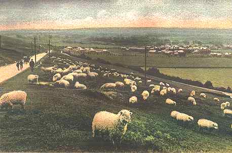
But now I come to one of the great objects of my journey: that is to say, to see the state of the corn along the South foot and on the South side of Portsdown-hill. It is impossible that there can be, any where, a better corn country than this. The hill is eight miles long, and about three-fourths of a mile high [sic], beginning at the road that runs along at the foot of the hill. 

On the hill-side the corn land goes rather better than half way up; and, on the sea-side, the corn land is about the third (it may be half) a mile wide. Portsdown-hill is very much in the shape of an oblong tin cover to a dish. From BEDHAMPTON, which lies at the Eastern end of the hill, to Fareham, which is at the Western end of it, you have brought under your eye not less than eight square miles of corn fields, with scarcely a hedge or ditch of any consequence, and being, on an average, from twenty to forty acres each in extent. The land is excellent. The situation good for manure. The spot the earliest in the whole kingdom. Here, if the corn were backward, then the harvest must be backward. 

... I came on to WIMMERING, which is just about the mid-way along the foot of the hill, and there I saw, at a good distance from me, five men reaping in a field of wheat of about 40 acres. I found, upon inquiry, that they began this morning [2 August], and that the wheat belongs to Mr. BONIFACE, of Wimmering. Here the first sheaf is cut that is cut in England: that the reader may depend upon. It was never known, that the average even of Hampshire was less than ten days behind the average of Portsdown-hill. 

The corn under the hill is as good as I ever saw it, except in the year 1813. No beans here. No peas. Scarcely any oats. Wheat, barley, and turnips. The Swedish turnips not so good as on the South Downs and Funtington; but the wheat full as good, rather better; and the barley as good as it is possible to be. In looking at these crops, one wonders whence are to come the hands to clear them off. 


Portsdown Today

Grazing stopped shortly after the end of World War Two. From then on scrub and invasive tree species began to take hold of the southern hillside. By the early 1990s it was just about impossible to walk from west to east along the southern slope. Fortunately by the late 1990s things began to change. 

A greater part of the hill was split in 11 compartments. Management of compartments 1-10 is implemented by the Portsdown Hill Countryside Service (PHCS), which is based at Fort Widley. The PHCS has a single employee (Portsdown Hill Countryside Officer) and is part of Portsmouth City Council’s Leisure Service. A public consultation group meets every six months. Practical management of the site is carried out by the Portsdown Hill Countryside Officer, contractors, volunteers and various community groups. Most of the volunteer work is done by the Portsdown Hill Conservation Volunteers who meet weekly and one weekend a month. A Portsmouth-wide Ranger service, the City Rangers, also patrol the site occasionally. Certain legal and administrative functions are carried out by other departments within Portsmouth City Council.

The PHCS is directly responsible for the management of other areas of non-S.S.S.I land across Portsdown Hill and is active in influencing the management of land in the control of agencies such as the, MoD, utilities and farmers. 

Compartment 11, often referred to as Portchester Common, is managed by Fareham Countryside Service (FCS). Many aspects of the management of the western compartments (1 and 11) is carried out collaboratively between PHCS and FCS for instance the PHCS arranges the grazing for both compartments and the livestock are driven through an adjoining gate. Joint work parties repair damaged fences.


A Note on Car Parking - June 2005

The provision for car parking on Portsdown has always been abysmal. There are a handful car parks, only one is surfaced and another has the capacity for only a dozen cars the rest are no better than lay-bys. The western end of the hill has no car parking at all. Considering the super human efforts of the Portsdown Hill Countryside Officer and the Portsdown Hill Conservation Volunteers in opening up this marvellous amenity you could have expected the situation to have improved. Well it's got worse thanks to Portsmouth, Fareham and Winchester Councils. As from June 2005 all parking on the hill is now banned except for the inadequate parks mentioned above. This ban is in force for 18 months (end 2006) when it is expected to become permanent. Complaints about this scheme are encouraged. You should send them here
 

What's in a name?

There is a bit of a debate as to the name - 'Portsdown Hill' or 'Portsdown'. Because 'Down' implies a chalk downland (i.e. a hill), the word 'Hill' is considered by some to be superfluous. I tend to agree with this, but it makes writing difficult - "I went down the down" - "I went down the hill"; most people just don't talk about Downs. Maps use the term 'Portsdown' for the general area, but there is a road on (the hill) called "Portsdown Hill Road". Anyway, I usually use the term 'Portsdown' except where I have to emphasis the fact that Portsdown is a Hill. 


See Friends of Portsdown Hill website for more details


Widley Windmill

Widley windmill on the top of Portsdown. This print depicts its demolition to make way for the building of Fort Widley in the 1860s. The Duke of Cambridge and his staff are carrying out an inspection of the works.


Portsdown Fair 1930

The 1930 Fair on Portsdown. This originally started off as a "Trading Fair"; an extension of the Free Mart Fair held at Old Portsmouth. As time went by it transformed into a "Fun Fair" with all the usual attractions. It was very popular with local people. A small lock-up was built to the east of Fort Widley to hold trouble-makers. They were released when the Fair ended.


Troops on Portsdown

Military encampment on Portsdown. The date is unknown but I would suspect that WWI would be a good guess. This is the site of the present day Queen Alexandra Hospital. Fort Widley is in the background, with a fine example of a downland environment in front of it. 


Troops at QA

NEW - 13-08-06

"My aunt has loaned me a number of old family photographs. One photograph is of my grandfather, William Nicholson from Middlesbrough, centre front, in the Royal Army Medical Corps during world war one, when he was based at the military hospital, Portsdown Hill.  My guess is the photograph was taken at or near the location of the photograph on 'Portsdown Tunnels' described as 'Military encampment on Portsdown'." [see previous photo]


John Yeadon, Bradford, West Yorkshire


Sheep grazing on Portsdown - 1905

This photograph was taken sometime between 1905 and 1910 by the artist FGO Stuart. It looks as if it was taken looking east, with the track on the left being Southwick Hill Road. The buildings on the top right are on the site of the present day Queen Alexandra Hospital. 


Fort Widley and Cosham 1905

Another photograph by FGO Stuart. This view is looking north with Portsdown Hill in the background. The building on the top left of the hill is Fort Widley. On the top right is the old Fair House which was redeveloped later as a petrol station. The earthworks running up to it are of unknown purpose and are still traceable. The village of Cosham is in the right mid-ground. Notice that the hillside is totally devoid of trees and scrub.

Photo interpreted by Barrie Nuttall - 02-03-04


Wymering 1938

NEW

Wymering 1938. The houses on the left are in Washbrook Road and mark the western edge of the Wymering housing estate at that time. From here to Portchester in the west, which includes the location of the Paulsgrove housing estate built in the late 1940s, it was all fields. At the top left of the photo is the Wymering Chalkpit where the Wymering Deep Tunnel Shelter is located. The kids in the back row are: my Uncle Jimmy, my Mum Bessie, and front row my cousins Brian and Shirley.


Fort Widley and Cosham 1969

An aerial photo taken in 1969 looking north. Fort Widley is on the upper left. The A3 runs from the bottom of the photo up to the George Inn. The chalk scar marks where Portsdown Park is under construction, only to be demolished in the 1980s. The scrub is taking a hold on the hillside.


grazing returns to Portsdown December 2002

After a break of half a Century grazing returns to Portsdown. This photo was taken on Portchester Common during December 2002. Two days previously these cattle were munching their way through the scrub in Compartment 4 - just east of the Paulsgrove Chalk Pit.


Then & Now Photos

<

About Portsdown

page 1 of 3

 >