|
|||||
| Created 25-02-2002 Last update 21-07-2019 | |||||
|
|
|||||
|
|||||
|
|
|||||
 |
|||||
|
|||||
 |
|||||
|
|||||
 |
|||||
|
|||||
 |
|||||
|
|||||
 |
|||||
|
|||||
 |
|||||
|
|||||
|
|
|||||
|
|
|||||
|
More emails on this subject: |
|||||
|
NEW 07-12-2008 |
|||||
|
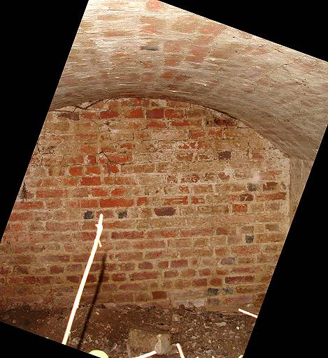
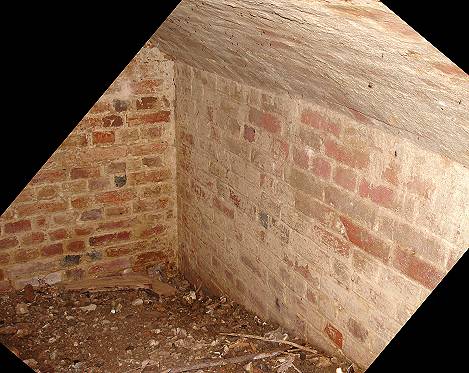
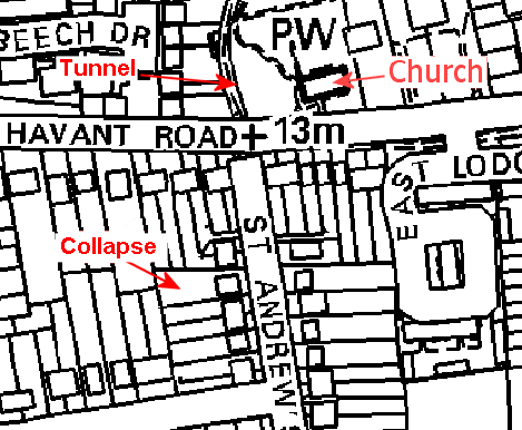
Looking at your page about the Farlington aqueduct, the following may or may not have any reference.
During the summer of 1976 my brother was then living in Saint Andrews Road Farlington when his neighbours front garden, 4 St Andrews collapsed due to the weather. The tunnel I recall was partially lined. Portsmouth Council or museum was called in and they decided as the tunnel was only about 10ft long due to collapse was of no interest and was probably a smugglers tunnel running to St Andrews church. It was subsequently filled in and the front garden of no. 4 restored. This section of tunnel ran approximately NE to SW.
Pete Baxter - December 2008 |
|||||
|
|
|||||
|
|
|||||
|
NEW 23-03-2008 |
|||||
|
|
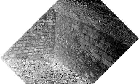
First things first - what a fantastic website! I first discovered it about a year ago, and have found out so much about the town I grew up in, and love, that I never knew before. I've sent it onto most of my family, and it's a great hit with them too. Please do keep it up - it's one of a kind, truly! Anyway, onto the reason I was writing to you...
I was particularly interested in the story about the Farlington Aqueduct
as it brought back memories of a story my mother used to tell me. I was
born in Farlington in 1972, and I distinctly remember her telling me about
a tunnel under her uncle's garden. I spoke to her today to find out some
details, and it certainly fits in with the updates you've just posted.
Her uncle and aunt, Jim and Ede Vincent, lived at 2 St Andrews' Road. In
the late 1970s or early 1980s. Whilst my uncle was mowing his lawn, part
of the garden collapsed underneath him. The collapse revealed an
underground tunnel a couple of metres below the surface which had been
partly filled-in. At the time I distinctly recall her telling me that he
investigated, and that the tunnel ran up to St Andrews' Church and was
thought to be a "smuggler's tunnel" since it also continued in a southerly
direction. Unfortunately all I know beyond that is that the hole was
filled-in shortly after, and that my uncle and aunt have both now passed
away. However, 2 St Andrews road would fit in very well with the idea that the aqueduct ended "80 yards south-southwest of St Andrews' church".
Richard Shipton - April 2008 |
||||
 |
|||||
|
|||||
|
|
|||||
| NEW 21-07-2019 | |||||
|
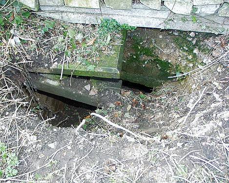
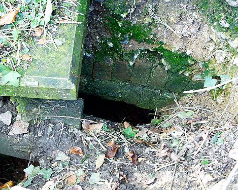
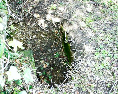
I grew up at 80 Old Rectory Road (the new section of Old Rectory Road) and my mother still lives there.She moved in in 1975. During the 1980s on two occasions there was a collapse into what was probably a well, but might have been something different in the garden of no.78.
I remember looking down into a partially collapsed hole that was at
least 6 feet deep and was brick lined. It was narrow (only about 1 ft
square, but would originally have been larger).It was back-filled with
rubble by the owners of no 78 (long since moved) and grassed over. Though it was probably a well, I have yet to find a decent map of the area pre-construction of Old Rectory Road to identify the exact location what I understand were farm buildings near there. What is interesting is that this location (78-80) Old Rectory isn’t that far off being directly north of the St Andrew’s road site mentioned on your website and the St Andrew’s church yard find. Looking at the free old OS maps on the Scottish public library, I think it might be the well of Uplands. A house marked on maps from mid 1800s to early 20th century. Or a well for cattle. Uplands seems to be more or less where no. 78 or 80 Old Rectory now are.
If you look at the old OS maps, the cast iron fence which separated the
field which Uplands was in still runs along the back of the gardens of
the upper houses of the 'new' (70s) part of Old Rectory Road. The fence
is in good shape and runs all the way from number 74 (the first new
house on the north side of Old Rectory) to where it hits Gilman Lane. So
the old field fence is still there 100 years or more after it was put
in. |
|||||
|
|
|||||
|
|||||
|
|
|||||