|
|
| Created 11-04-2005 Last update
22-04-2005 |
|
|
|
|
|
|
|
|
| |
|
|
The
pipeline now leaves the residential area and enters open fields with the hedgerows more or less as they
were in 1939.
Google
Earth Aerial View
|
|
| |
| |
| |

|
|
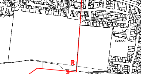
Location
R, looking north. The pipeline ran
alongside this fence probably on the other side. Fort Nelson is on
the right skyline.
The
inset shows a marker post which is in the boundary hedge behind the
camera just where the pipeline turns west. The letters VP72M are written
on it. Does anyone know what this means?
|
|
| |
| |
| |
|
|
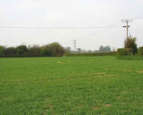
Location
S looking west. The dogleg in
the north hedgerow can be seen on the right. The pipeline runs
across this field and under the boundary hedge on the left into Wicor
sports ground.
|
|
| |
| |
| |
 |
|
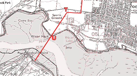
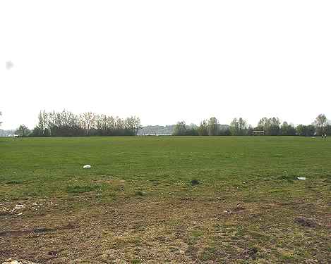
Once
inside the sports ground the pipeline turns 45 degrees south and
makes for the upper reaches of Portsmouth Harbour - sometimes
called Fareham Creek. Here it crosses
under the water making landfall in Gosport just east of Foxbury Point.
Google
Earth Aerial View
|
|
| |
| |
| |
|
|
Location
T looking southwest towards Wicor
Hard. The pipeline makes for the sea in a direct line through the gap in
the trees.
|
|
| |
| |
| |
|
|
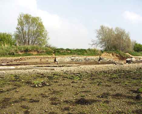
Wicor
Hard - location U looking
northeast. The pipeline entered the sea at this point.
|
|
| |
| |
| |
 |
|
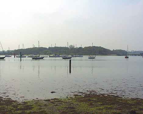
Wicor
Hard - location U looking
southwest to DARA Fleetlands (Defence Aviation Repair Agency) in
Gosport. The post in the centre of the photo looks as if it was a
pipeline marker; there is another close to the other shore.
The
"PORTSMOUTH NEWS" carried a report in the late 1990s
which stated that the harbour section of the pipeline had been
removed, resulting in 200 gallons of fuel oil spilling into
Fareham Creek and threatening wildlife.
|
|
| |
| |
|
|
|
|
|

|