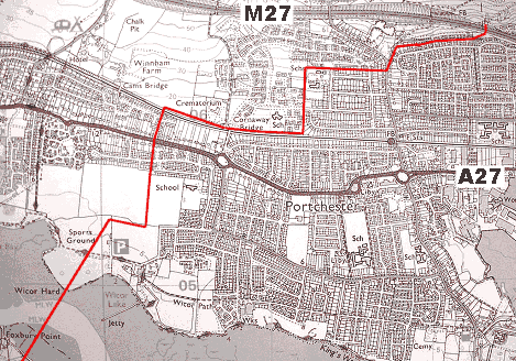
Naval Fuel Pipeline

 Created 11-04-2005   Last update 22-04-2005

<

Fuel Pipeline

page 1 of 5

>

 Fuel Bunkers


The five 
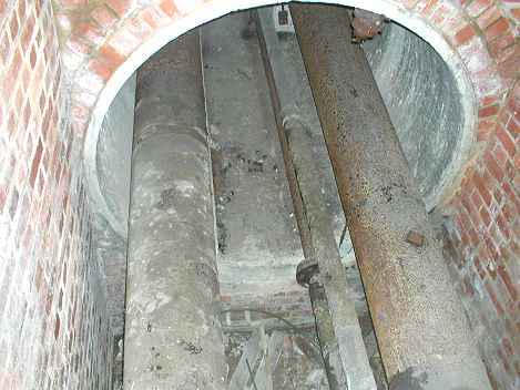
and half mile long pipeline was installed in the early 1940s and linked the Oil Fuel Reservoir on Portsdown with the Admiralty Oil Fuel Depot at Forton in Gosport reportedly using 1 x 10 inch and 2 x 16 inch pipes. 
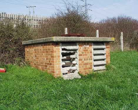
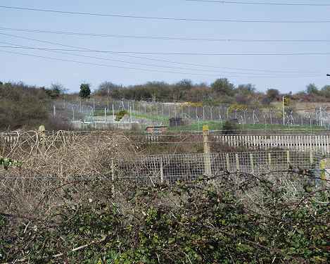
There were inspection pits situated at regular intervals along its length containing isolation and diversion valves. At the Invergordon Fuel Depot electrical fuel heaters (to make the fuel oil less viscous in winter) were installed every 200 yards but there is no evidence of their use at Portsdown. After WWII, as the area around the pipeline was built on, a 15 foot wide strip of ground  above it was fenced off using 4 foot concrete posts and chainlink fencing. 

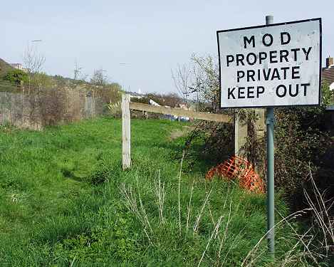
In 2005 when these webpages were written, around 10 years had passed since the pipeline had been decommissioned and most of the evidence of its existence  had disappeared with the exception of a 1970s built inspection pit, one sign and odds and ends of fencing. The residents of the area had been offered the chance to buy the pipeline land if it ran next to their property and most of them have done so. This land is now classified as 'contaminated' and cannot be built on.

The following pages chart the route of the pipeline from the Fuel Bunkers to the point where it crosses Portsmouth Harbour to Gosport. 
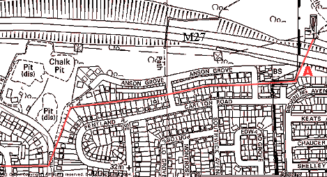
On the Gosport side the pipeline makes landfall near Foxbury Point in Fleetlands. From here it goes south through Bedenham, RNAD Frater, Priddy's Hard, and under Forton Lake to the Oil Fuel Depot. A booster pump house was located just behind the North Star Pub, and was kept in running order until it was demolished in the 1990s.


Contributors:  Andy Salter Ian Dunkley
Tony Triggs Peter Crowson
Neil Russell Bazzer
Gavin Rowe Norman Beckett
Stella Bell Red Barn Primary School
 

Thanks to all the residents living near the pipeline 

who assisted with my research.


Map of the northern pipeline

This is the land north of Portsmouth Harbour where the fuel pipeline (shown in red) runs from the bunkers and across the Harbour to Gosport. The Bunkers are on the top right. Hardly any of the buildings existed when the pipeline was constructed in 1939 and it was quite often routed along existing field boundaries.

Google Earth Aerial View


Anson Road

From the Fuel Bunkers on the top right the pipeline runs under the M27 in a culvert (conduit) which was built along with the motorway in the 1970s when the pipeline had to be re-aligned. 

Google Earth Aerial View


Inspection Pit

Location A on the above map. This is the only Inspection Pit left along the pipeline route outside of the Fuel Bunker compound. It is situated south of the Fuel Bunkers and the M27 Motorway.


Inside the pit

It was just possible to pass a slimline camera through the broken louvers shown in the previous picture and take a series of blind photos. This is the result. It shows the pipe tunnel heading north under the M27 Motorway carrying two 16 inch pipes and two (possibly) 5 inch pipes which may be used for fire fighting. There is no sign of the 10 inch pipe mentioned on the 1939 plans. From here the pipe tunnel ends and the pipes travel south in contact with the ground.  


Fuel Compound

This is the view north when standing on the structure in the previous photo. The nearest fences are for the M27 Motorway which is in a cutting running left to right. The western fuel bunker compound is beyond them, and the northern inspection pit can be seen in the centre of the photo. This must be very deep.


Pipeline Route

A few yards away from the inspection pit the pipeline turns west under this grass. This sign is the only one left along the pipeline route.


<

Fuel Pipeline

page 1 of 5

>

 Fuel Bunkers